NatureServe Data and Tools for the Bureau of Land Management
Support: For help, contact the NatureServe BLM Support Help Desk at BLM_Support@natureserve.org
This article provides a directory of the data, tools, and support resources NatureServe provides to the Bureau of Land Management (BLM). Resources are grouped into six categories, listed below. Each entry includes a short description, instructions for accessing the resource, and a support contact.
Contents
- NatureServe Conservation Data Portal for the Western United States
- BLM West-Wide Data License
- NatureServe Explorer
- NatureServe Explorer Pro
- NatureServe Network State and Provincial Data
- Survey123 and Observations Tools
- BLM SSS Project
- BLM Data Flow Project
- BLM SSS Prioritization Tool
- BLM SSS Richness Map
- Species Habitat Models
- Species Habitat Model Dashboard
- NatureServe Model Output Review Tool
- Western Monarch Migration Models
- NatureServe Ecosystem and Ecology Data
1. General Resources
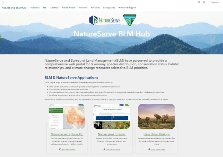
NatureServe BLM Hub NatureServe’s BLM Hub is a comprehensive single point of access to data collections, collaborative tools, habitat models, monarch migration areas, and customized applications related to BLM priorities.
How to access: Request access to the NatureServe BLM Hub
Support: BLM_Support@natureserve.org |
NatureServe BLM Hub homepage |
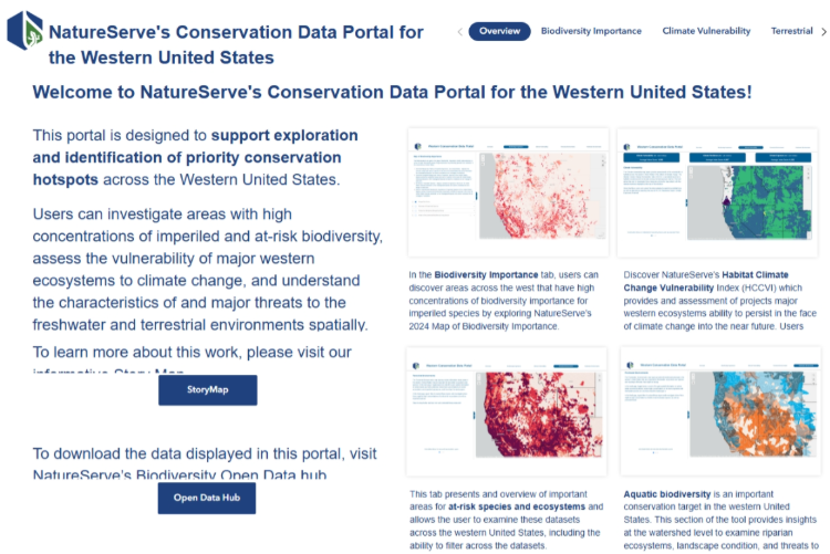
NatureServe Conservation Data Portal for the Western United States The Conservation Data Portal supports exploration and identification of priority conservation hotspots across the western United States. Investigate areas with high concentrations of imperiled biodiversity, assess ecosystem vulnerability to climate change, and understand threats spatially.
How to access: NatureServe Conservation Data Portal
Support: datasupport@natureserve.org |
NatureServe Conservation Data Portal for the Western United States |
2. Accessing or Collecting Biodiversity Data
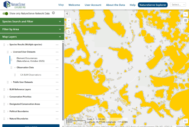
BLM West-Wide Data License The BLM’s NatureServe data license provides BLM staff with access to precise, taxonomically verified, and standardly mapped at-risk species locations (element occurrences, or EOs) and species habitat models for the BLM Western Region. The licensed dataset is accessed via the NatureServe Explorer Pro interface or can be downloaded through a Geodata Portal.
How to access: Instructions to access NatureServe licensed data
Support: datasupport@natureserve.org |
BLM West-Wide Data License via NatureServe Explorer Pro |
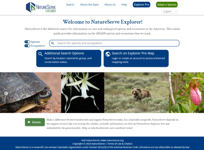
NatureServe Explorer NatureServe Explorer is the definitive source of information on rare and endangered species and ecosystems in North America, providing information on 100,000+ species and ecosystems. A public API is available for querying and integration into other tools.
How to access: NatureServe Explorer
Support: Explorersupport@natureserve.org |
NatureServe Explorer |
NatureServe Explorer Pro Explorer Pro extends NatureServe Explorer with interactive maps and place-based reporting, allowing users to explore where at-risk species have been documented (Element Occurrence and observation data) and where they may occur based on habitat models.
How to access:
Support: datasupport@natureserve.org |
|
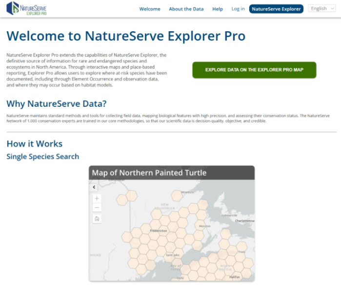 NatureServe Explorer Pr
NatureServe Network State and Provincial Data NatureServe member programs in states and provinces collect and manage data locally, then share it with NatureServe to aggregate. State heritage programs may have additional information on rare species and ecosystems tailored to local needs.
How to access:
Support: Contact your state heritage program via the NatureServe Network Directory or contact Network_Communications@natureserve.org |
|
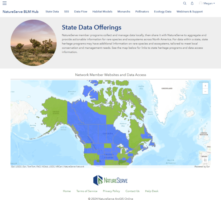 NatureServe Network Directory
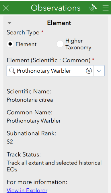
Survey123 and Observations Tools NatureServe can provide support in developing observations surveys in Survey123, customized to meet the needs of the state BLM office. Dashboards facilitate viewing, editing, and QC of data. An ArcGIS toolbox facilitates downloading survey data for BLM’s use and to share with the state heritage program.
How to access:
Support: BLM_Support@natureserve.org |
Observations Survey |
3. BLM-NatureServe Ongoing Projects
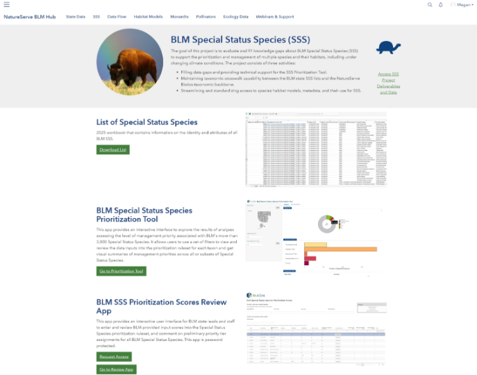
BLM SSS Project NatureServe’s BLM SSS project is an ongoing collaborative effort to evaluate and fill knowledge gaps about BLM Special Status Species (SSS) to support prioritization and management of species and habitats.
How to access:
Support: Grace Di Cecco, Lead Biodiversity Data Scientist, Grace_DiCecco@natureserve.org |
BLM Special Status Species project page |
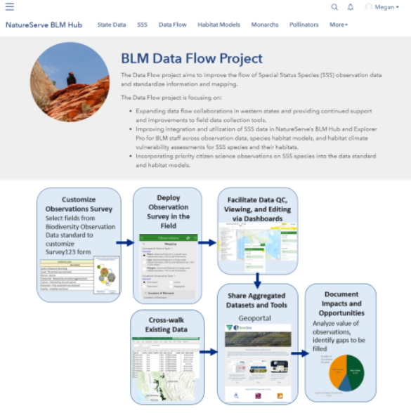
BLM Data Flow Project NatureServe’s BLM Data Flow project is an ongoing collaborative effort to improve the flow of SSS Observations data among the BLM, NatureServe Network programs, and NatureServe.
How to access:
Support: Whitney Weber, DBA & Product Support Specialist, Whitney_Weber@natureserve.org |
BLM Data Flow Project page |
4. BLM Special Status Species (SSS) Resources
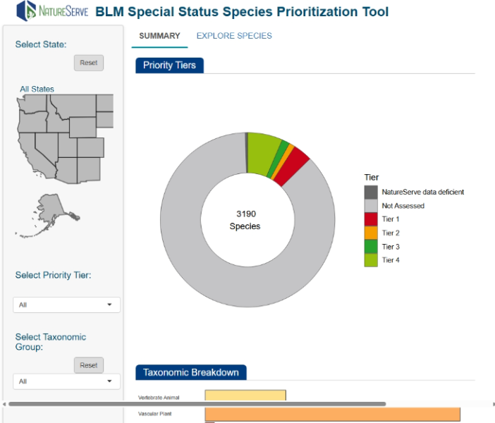
BLM SSS Prioritization Tool The SSS Prioritization Tool is an interactive interface to explore results of analyses assessing the level of management priority for BLM’s more than 3,000 SSS. Use filters to view data inputs and get visual summaries of management priorities.
How to access: BLM SSS Prioritization Tool
Support: data_science@natureserve.org |
BLM SSS Prioritization Tool dashboard |
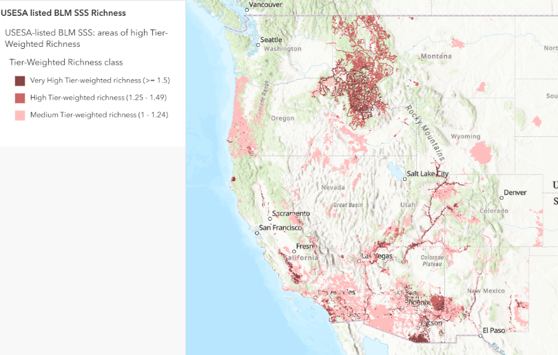
BLM SSS Richness Map The BLM SSS Richness Map highlights areas in western states supporting habitat for USESA-listed BLM SSS, with layers depicting overall species richness, SSS tier-weighted species richness, and species identities. Species habitat areas were derived from Element Occurrences and species habitat models. The map can assist in identifying priority areas for species recovery.
How to access: USESA listed BLM SSS Richness web map
Support: data_science@natureserve.org |
|
 BLM SSS Richness Map
5. Species Habitat Models
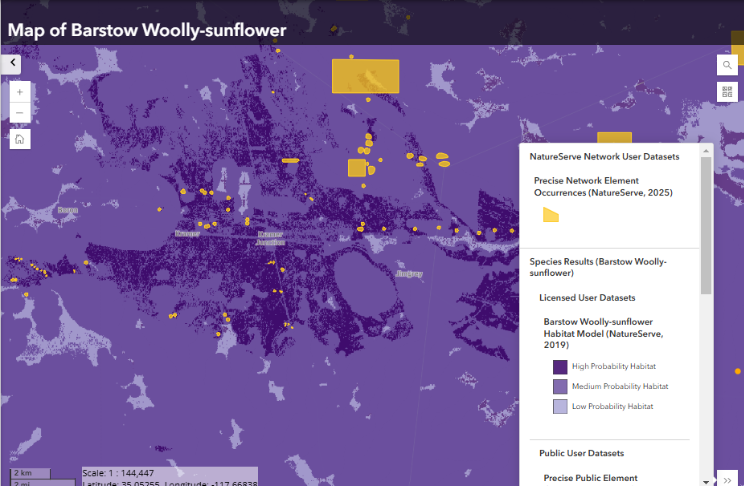
Species Habitat Models NatureServe’s species habitat models use multiple sources of occurrence and environmental data to predict the distribution of species’ habitats, supporting data-driven decision-making and improving efficiency in conservation and resource management.
How to access:
Support: datasupport@natureserve.org |
|
 Species Habitat Models
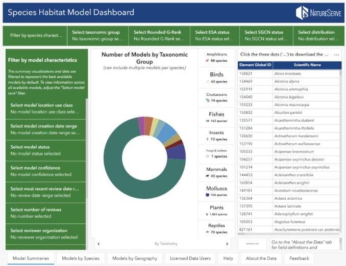
Species Habitat Model Dashboard The Species Habitat Model Dashboard offers a live view of completed and in-progress species habitat models. It summarizes data by model summaries, models by species, and models by geography.
How to access: Species Habitat Model Dashboard
Support: data_science@natureserve.org |
Species Habitat Model Dashboard |
NatureServe Model Output Review Tool BLM staff can use the NatureServe Model Output Review Tool to review species habitat models and provide expert input to guide future model revisions. User authentication is required.
How to access:
Support: data_science@natureserve.org |
|
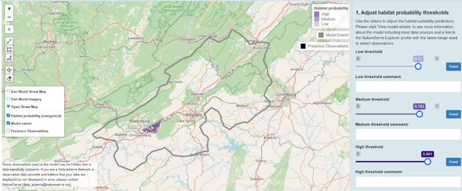 NatureServe Model Output Review Tool
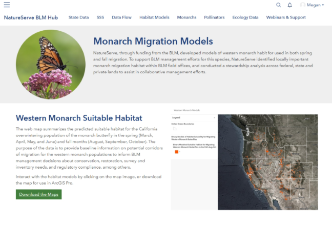
Western Monarch Migration Models Explore models of western monarch migration habitat by BLM field office, as well as an analysis of conservation stewardship across the western U.S.
How to access:
Support: Hannah Ceaser, Spatial Analysis Program Manager, Hannah_Ceasar@natureserve.org |
Western Monarch Migration Models |
6. Ecology Data
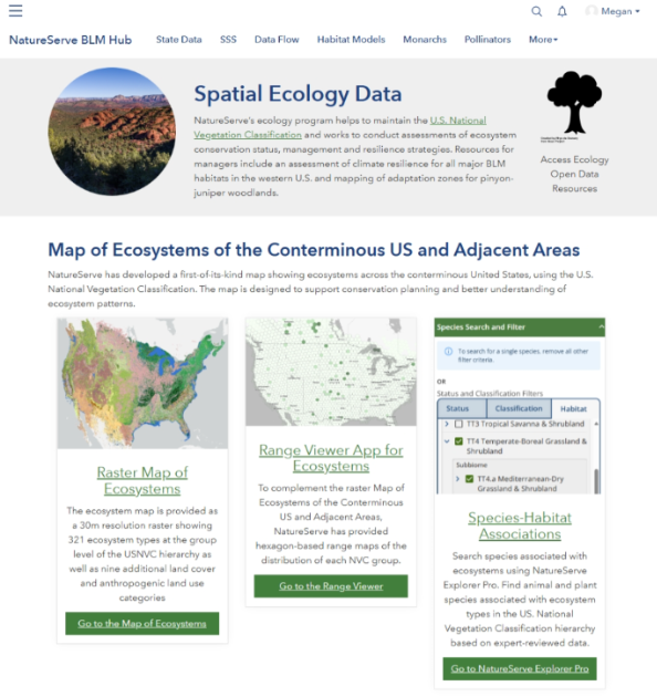
NatureServe Ecosystem and Ecology Data Maps of vegetation and ecosystems across North America, information on species-habitat associations, and vulnerability analyses for pinyon-juniper woodlands.
How to access:
Support: Don Faber-Langendoen, Senior Ecologist, don_faber-langendoen@natureserve.org |
NatureServe Ecosystem and Ecology Data |
Was this article helpful?
That’s Great!
Thank you for your feedback
Sorry! We couldn't be helpful
Thank you for your feedback
Feedback sent
We appreciate your effort and will try to fix the article